
Location
Ibiza, Spain
Program
City Master Plan
Dates
1996
Key Staff
Scott Nakao, Don Dimster, Paul Groh, Gevik Hovsepian, Christine Lawson, Augis Gedgaudas, Ted Brandt, Austin Kelly
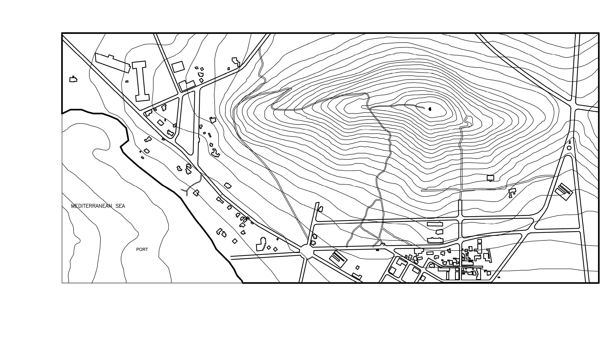
South of Barcelona, midway between Spain and North Africa, is the Catalan island of Ibiza – a burgeoning tourist center with a current resident population of eighty-five thousand, and a disproportionate visiting population of approximately two million. Over the millennia since the Bronze Age, the Phoenicians, Carthaginians, Romans, Vandals, Byzantines, Arabs and the current Catalans have left a remarkable built record of their cultures on the island.
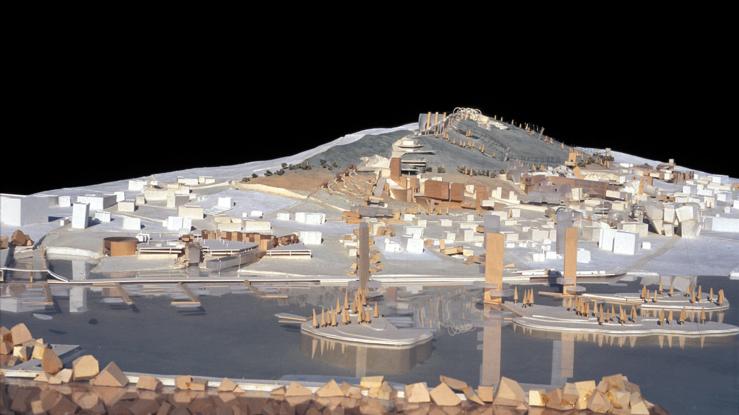
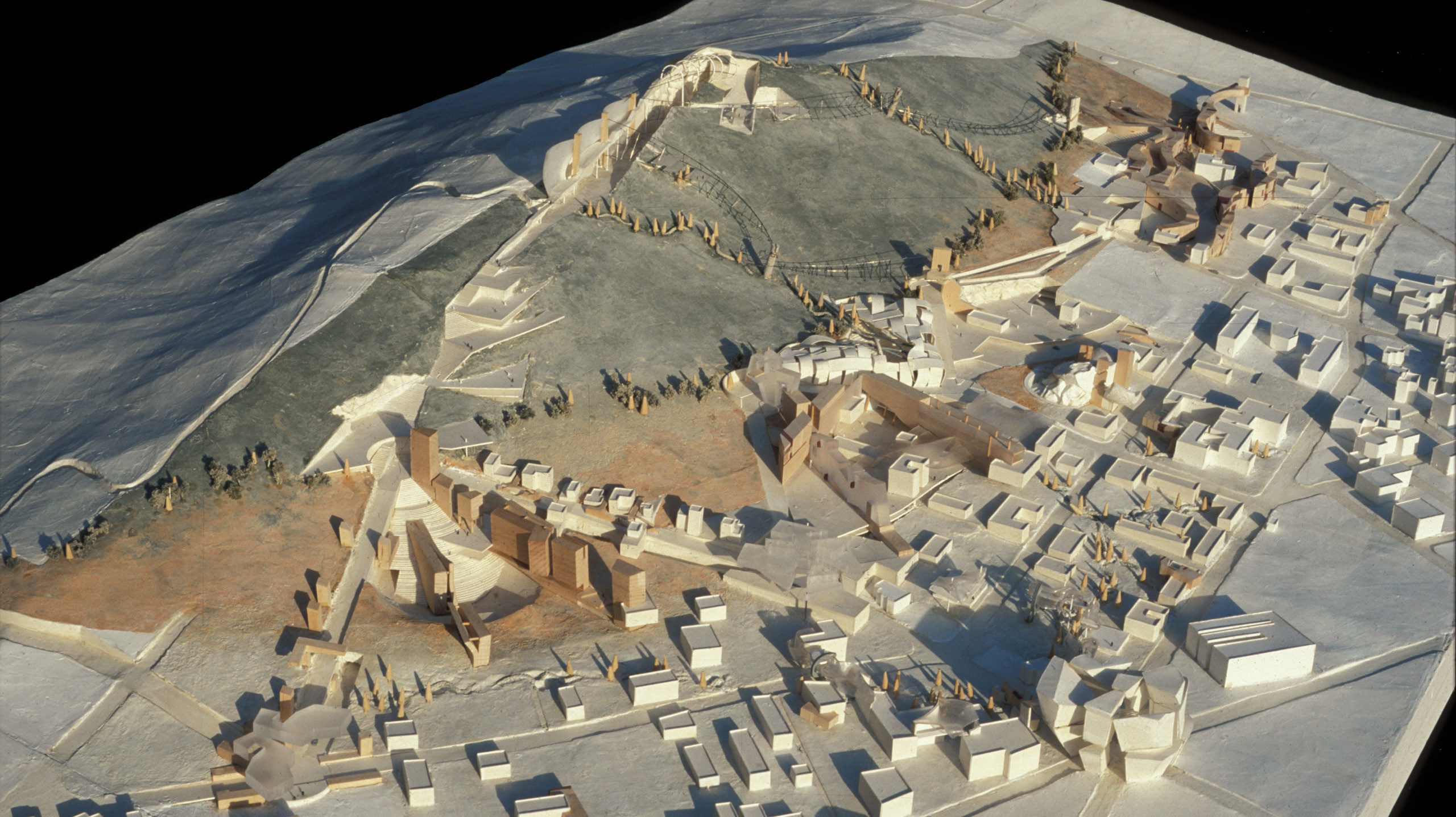
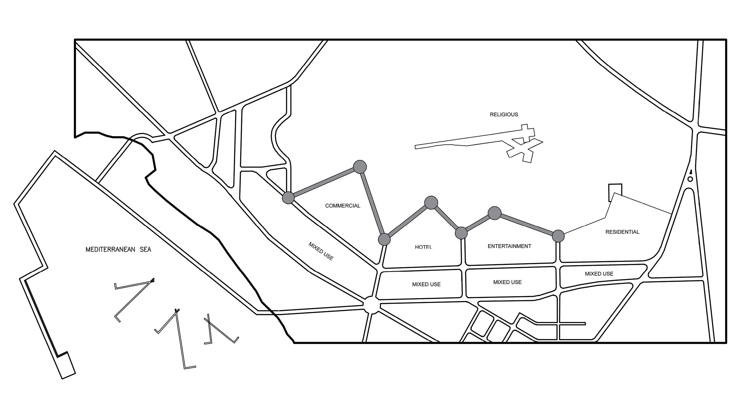
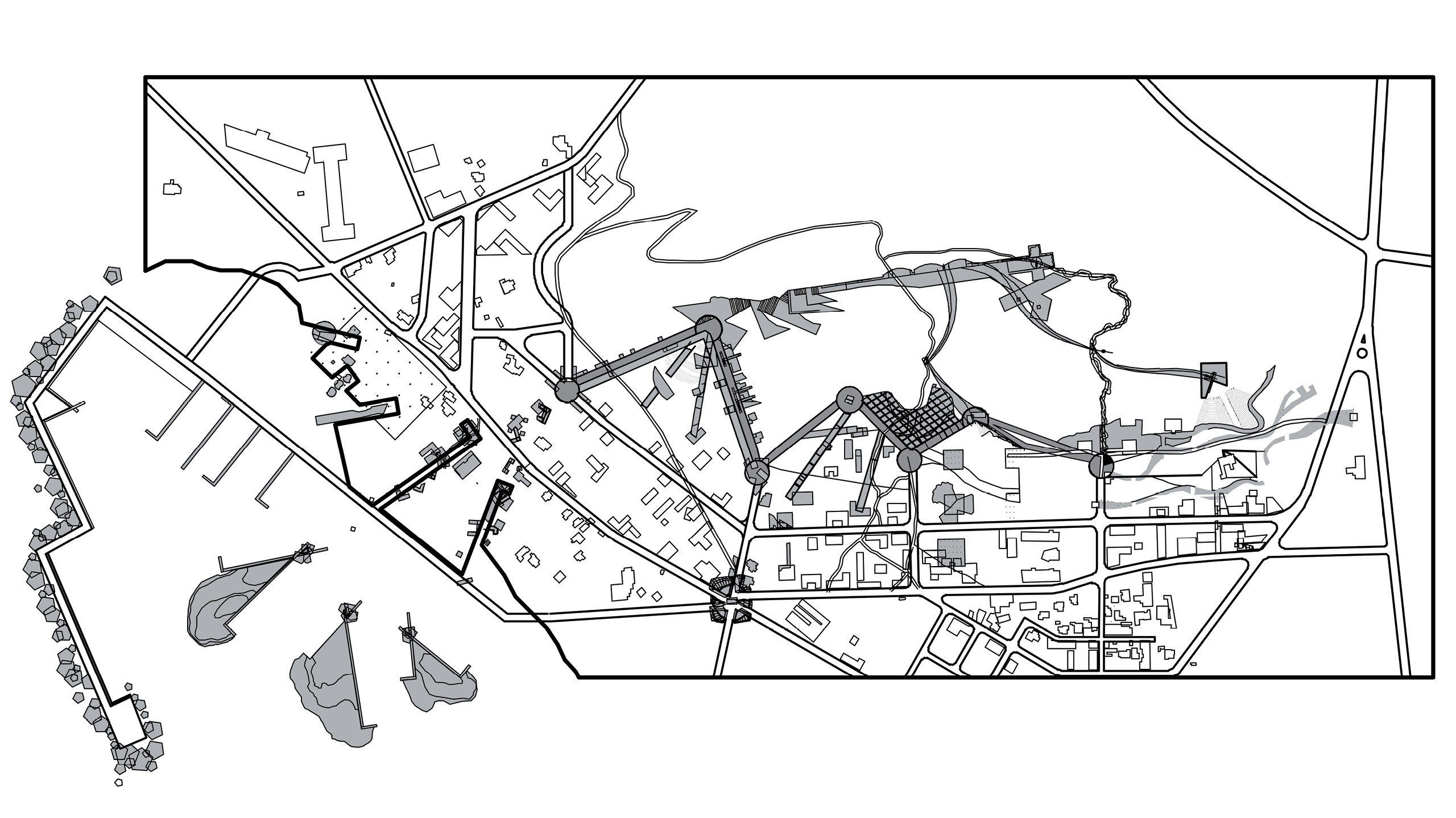
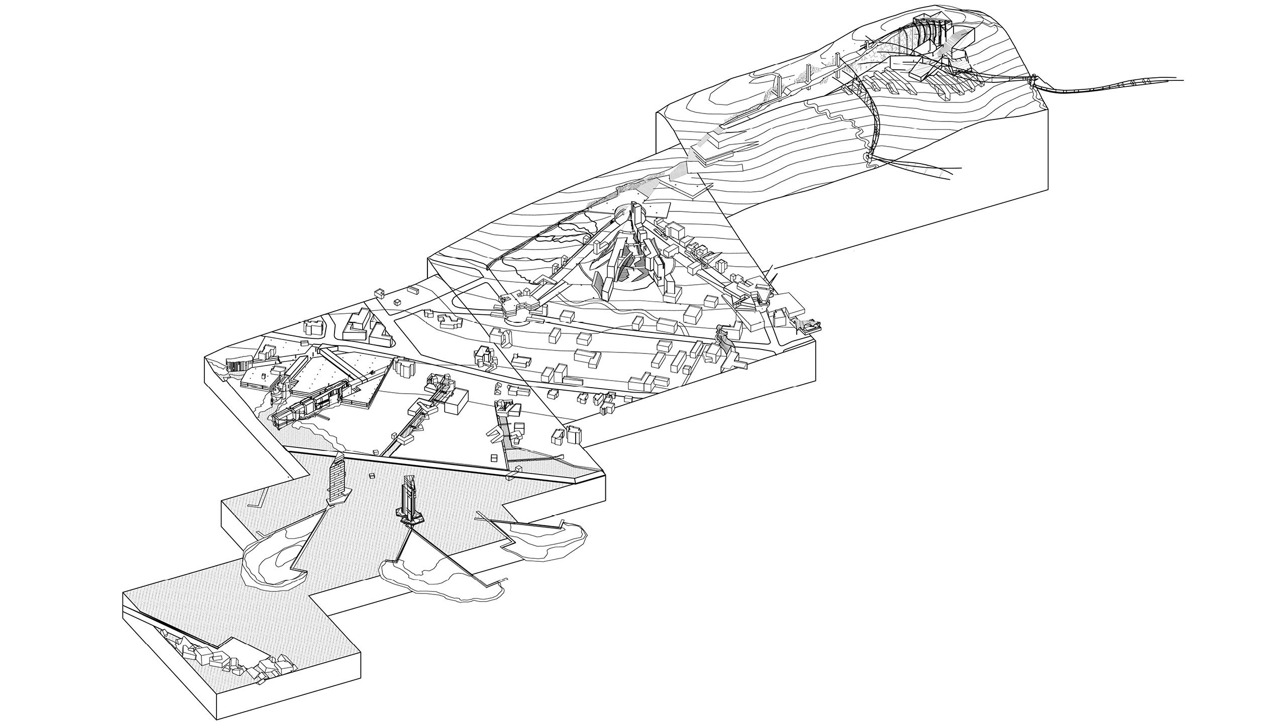
Ibiza City and the San Antonio are the two principal towns on the Island. The site for the proposed master plan will adjoin San Antonio to the north, and is organized east to west along the bay. The new site is four hundred meters deep, extending north from San Antonio up the S’Atalia hill, and fifteen hundred meters wide along the Mediterranean Sea. Primary roads are extended, linking the old town with the expansion. A new circulation spine is etched into the hill, providing new focal points in the city as well as affording different urban views while traversing across the hill. Six zones are defined: museum/cultural, port, commercial, hotel, entertainment, school and “et cetera.”
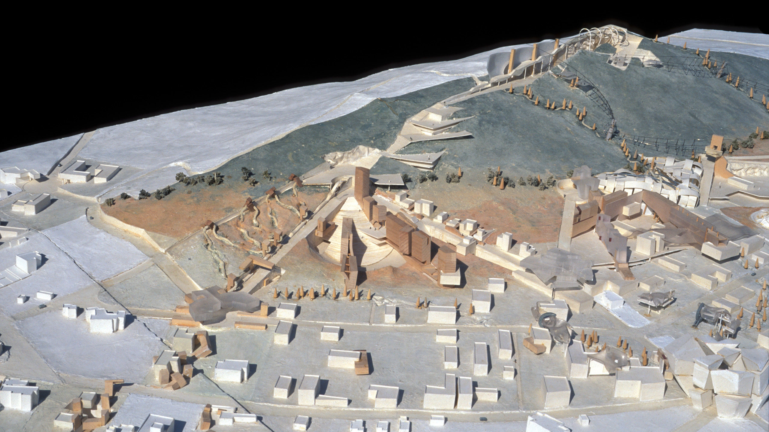
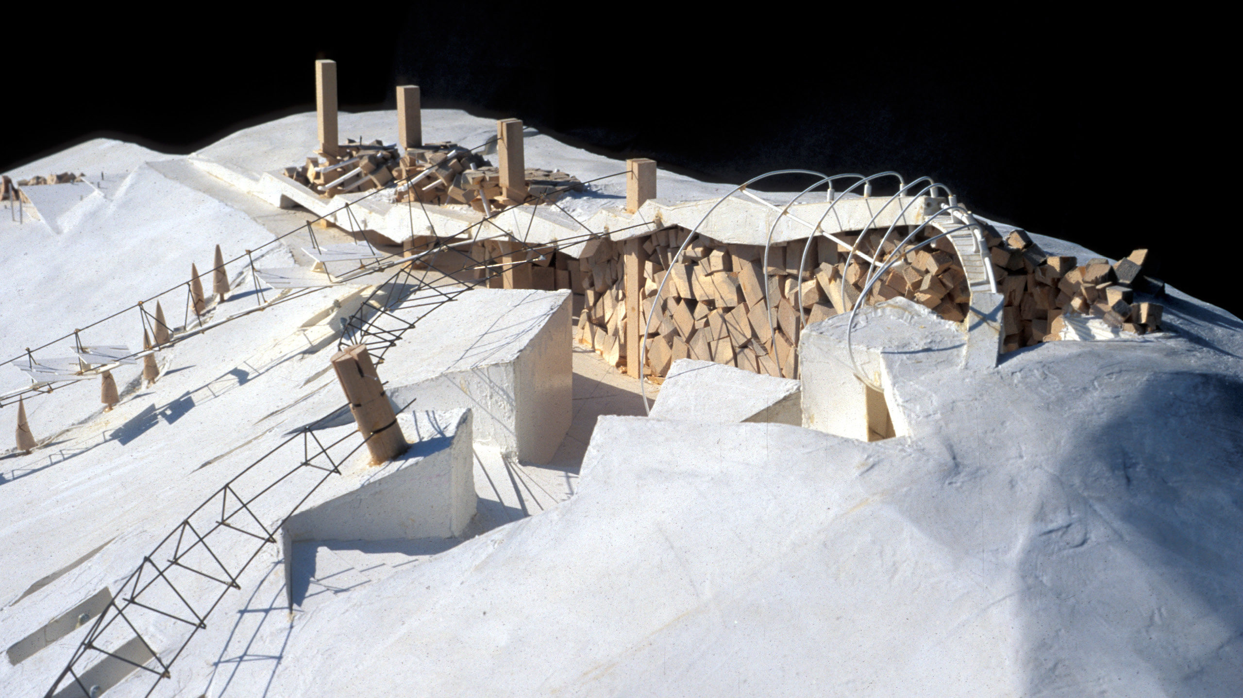
The top portion of the S’Atalia hill is designated as a “green area” which dictates that only public use projects are permitted in this zone. Consequently, at the top of the hill, within the original earth profile, a public walk will be excavated with platforms stepping down to the sea. A museum memorializing the various deities from the numerous cultures that inhabited the island will be built on the hilltop site.
At the base of the hill, a large breakwater will extend into the Mediterranean, enlarging existing harbor facilities and adding a marina, boat repair, fishery and beach access. Between the hill and sea is a new order of walks and streets anchored by seven viewing points and auto turnarounds along the base of the hill. New research and development facilities are to be developed – along with hotels, retail, offices, cinemas, and an open-air theater – around these points.
Bridges span from each viewing point over the green zone to the museum hilltop. Between the new urban development on one side and the old city on the other is the miscellaneous “et cetera” zone, with a variety of building types hybridized from the small-scale existing buildings and the larger-scale new construction.