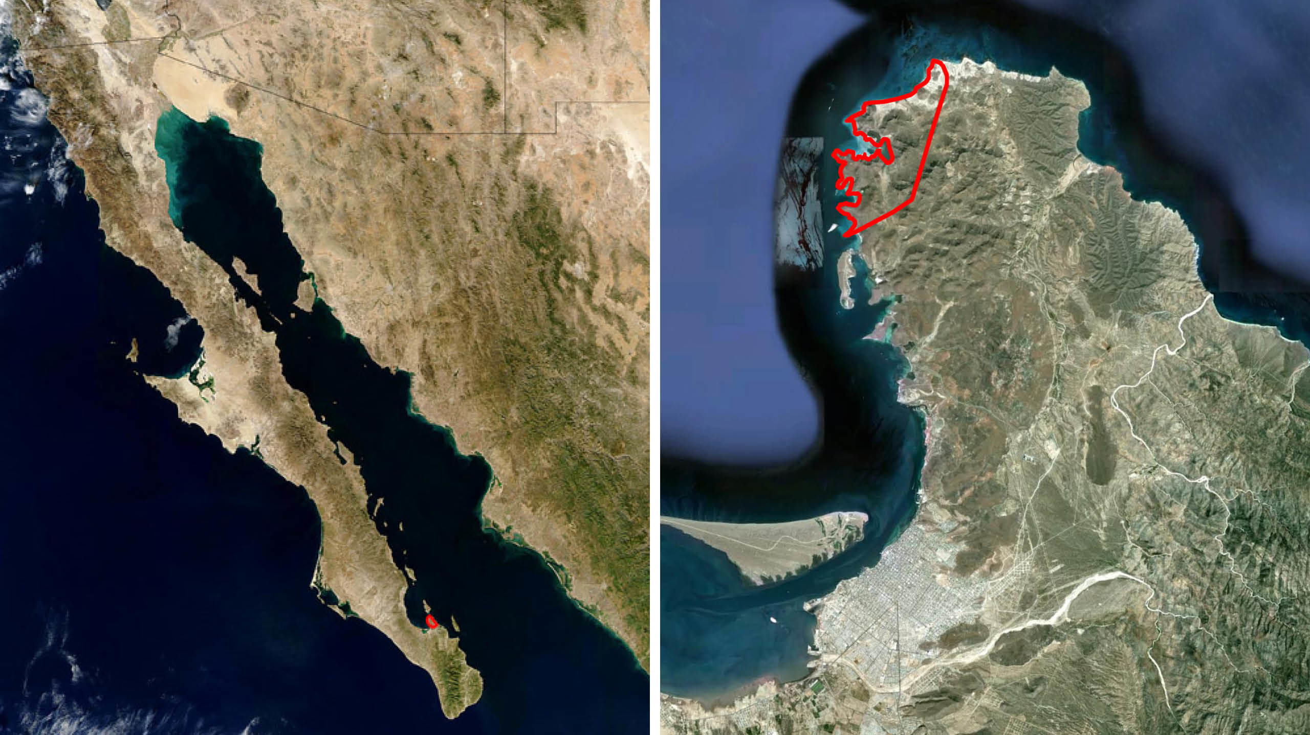
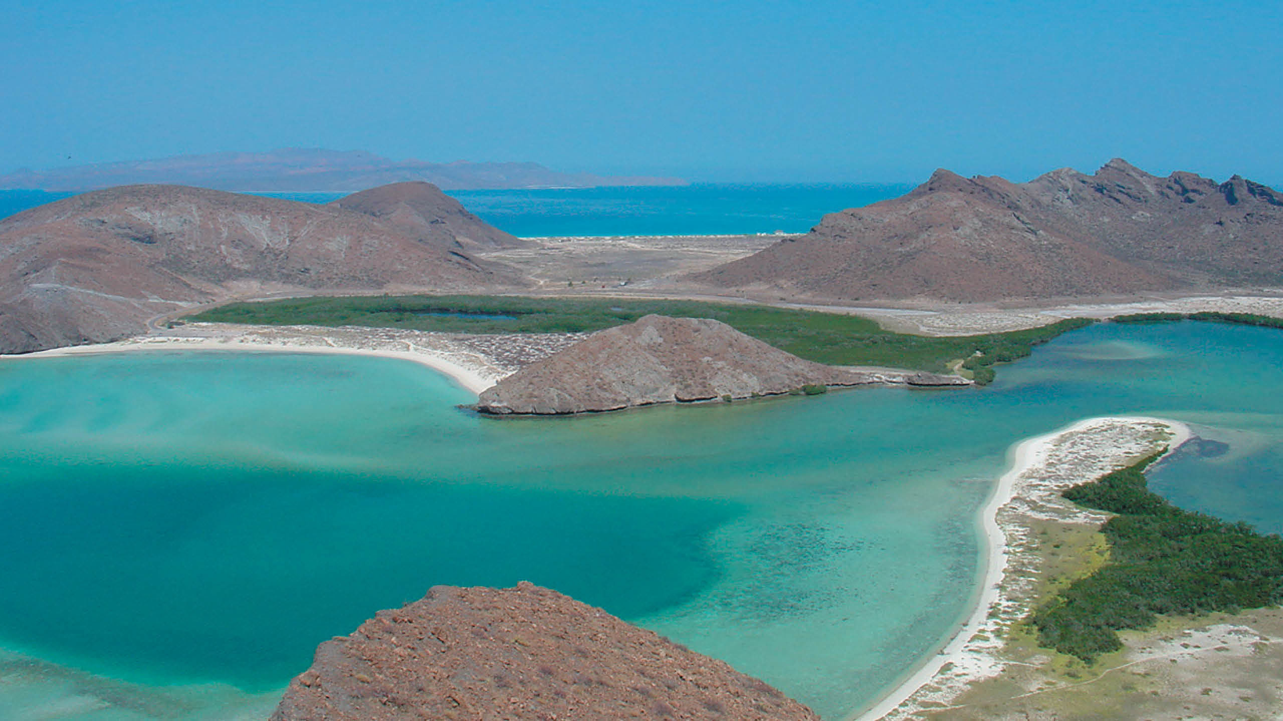
Location
Bahia Balandra, Mexico
Program
Master Plan
Dates
2006
Key Staff
Eric McNevin, Jose Herrasti, Dolan Daggett
Key Consultants
Project in conjunction with SCI-Arc, Universidad Ibero, Universidad Anahuac, Stanford Humanities Lab, and the Getty
Environmental: Arup
Economics: ERA
The Balandra project gives the opportunity to conceive a city on the [almost] untouched Balandra Bay in the Sea of Cortez.
But what city?
The coastal city?
Or the Mexican coastal city?
Or the Mexican coastal resort city?
Or the Mexican coastal resort ecological city?
The intervention plan seems to imply altering, to some degree, the original, invaluable experience of the site. So the question is, is it possible to both preserve and to alter Balandra, or, in other words, to plan to inhabit the Balandra site in a way that sustains its original, natural poetry? There is no single response to that paradox, no trick solutions to retaining the site as it currently exists, and replanning the site to accommodate a range of different uses. So there exists a number of challenging conceptual choices to be made, and the objective is to formulate articulated planning and design options, and evaluate the assets and liabilities of each.
The governing project concepts include: a quality of exclusivity, a uniquely Mexican identity, a precedent-setter for city design, and a commitment to environmental and ecological objectives. A team composed of Eric Owen Moss Architects, and members from The Getty, Stanford University, SCI-Arc, Ove Arup Associates, and Economic Research Associates carefully evaluated conceptual ecological alternatives both as planning tactics and as symbols. The project is considered as potentially ‘didactic’ [that is, using the Balandra plan as a ‘teacher’ of new city-making]; it reviews a number of program options [educational, cultural, research/development, office and residential uses, and resort facilities]; it examines the potential role of public policy/land use issues including private versus public access to the coast; and it studies various alternatives for access to/from the site and transportation within.
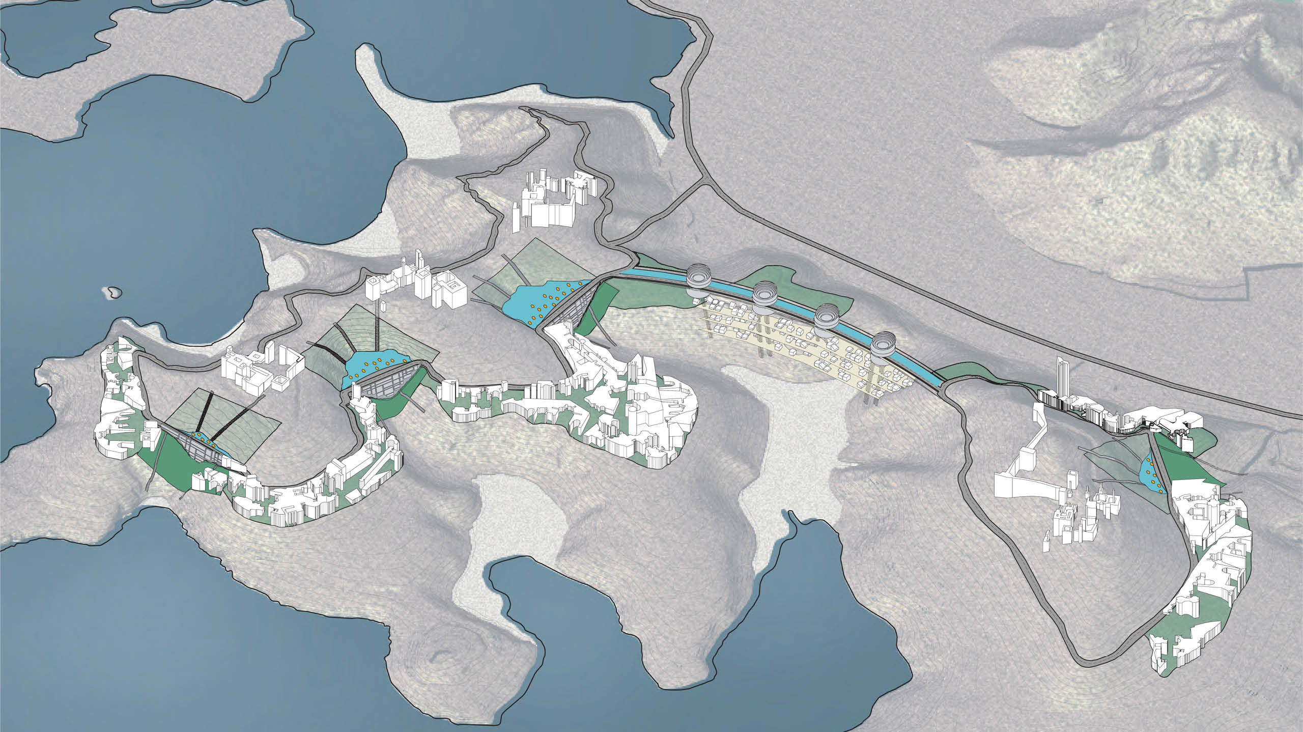
The team arrived at four provisional planning concept conclusions, each of which suggests very different design responses to the issues noted above. Ultimately, the solution may be one of the four or a recombination of the prospective solutions in a scheme or schemes not yet presented.
The four schemes are: the ‘Tunnel-Tower’, the ‘Island’, the ‘Cistern’, and the ‘Sidescraper’.
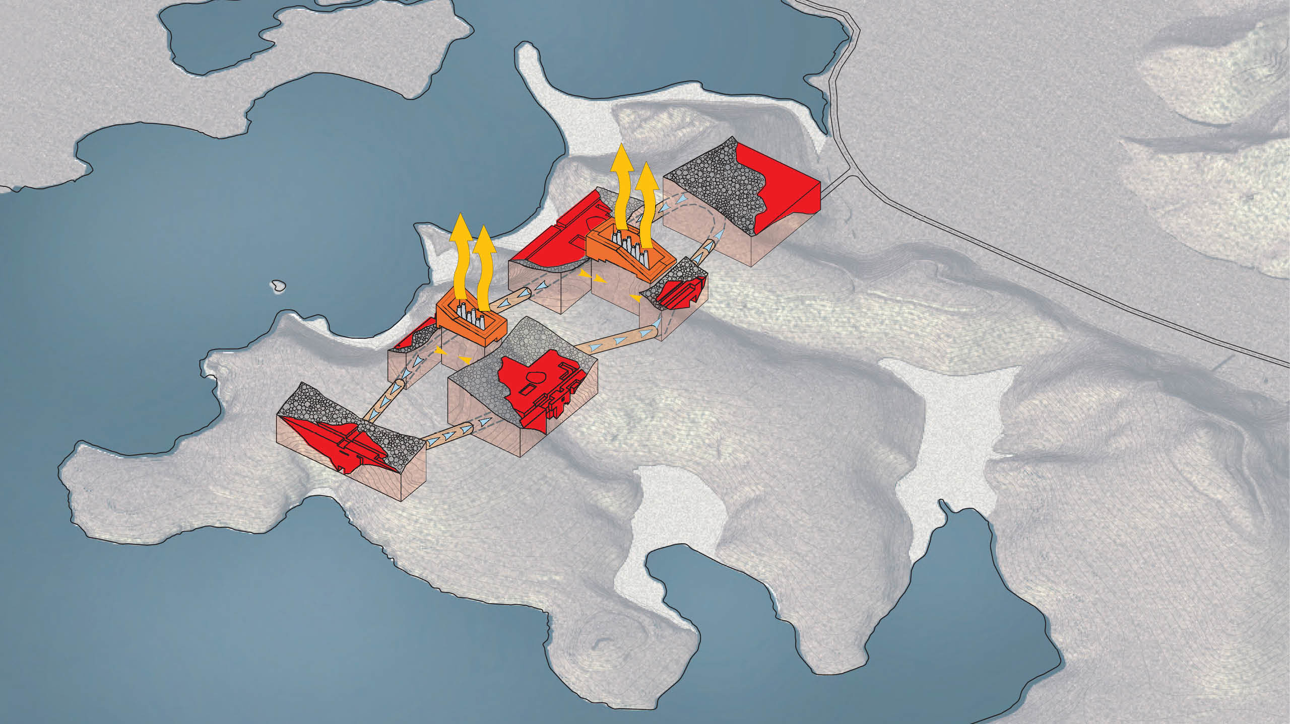
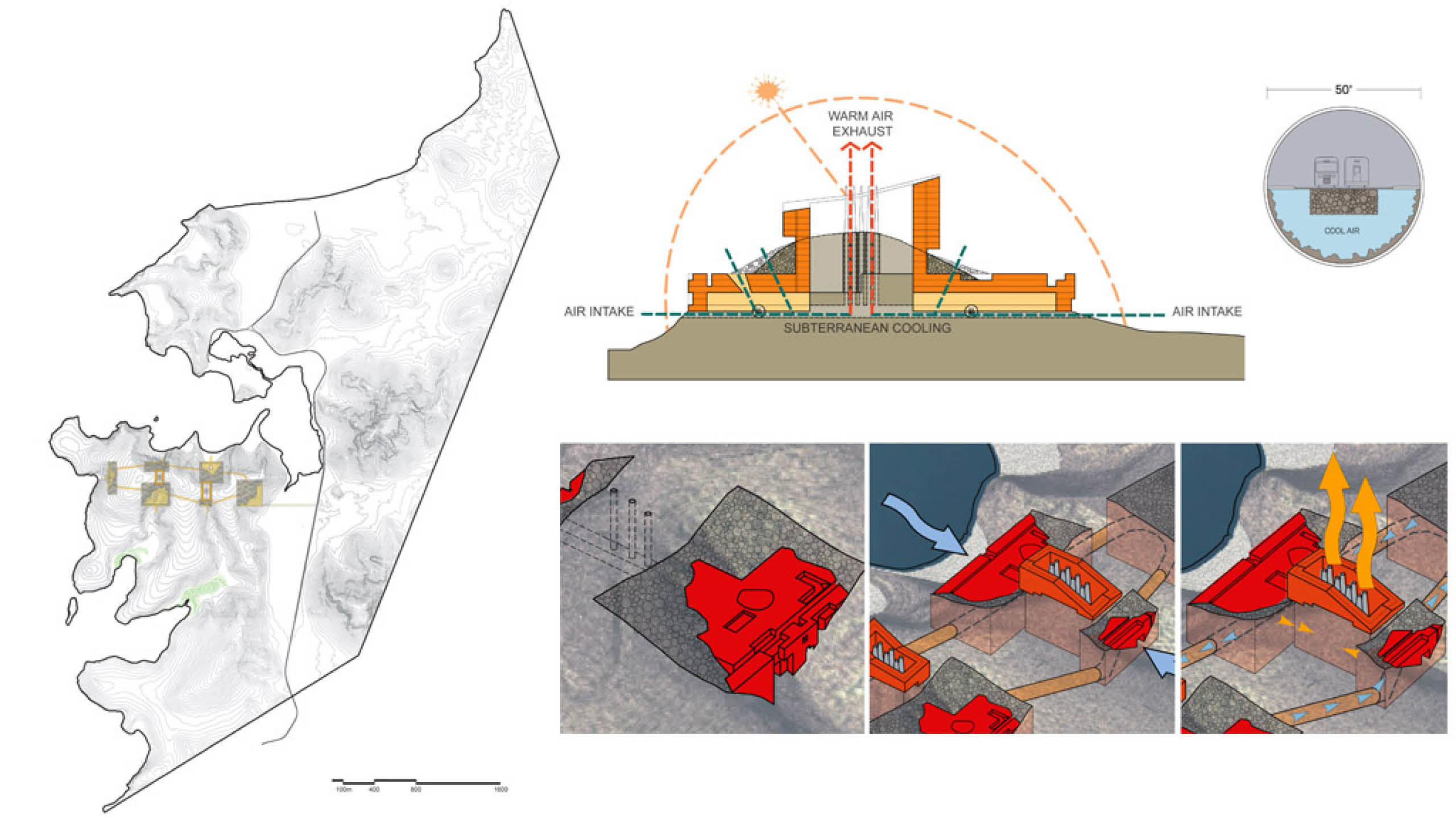
TUNNEL-TOWER
Concept: Reduce the development’s visual impact while drawing ecological advantages from below grade construction.
The mountain is excavated across several valleys, with new structures offering spaces both above and below ground. The structures are connected via a tunnel system that provides transportation across the site, and connects beaches on opposite sides of the mountain.
Exhaust chimneys are connected to the tunnel system, which is used for ventilation and cooling. Loose rock from the excavation is used to reconstruct some of the natural topography, partially covering up the new structures, while filtering the air entering the ventilation system.
The buildings are constructed around the exhaust chimneys that link to the ventilation tunnels in such a way that they allow direct sun exposure to the chimneys. When warmed by the sun, the chimneys remove warm air from the tunnels, which is replaced by cool air, circulating the air within the tunnels. These structures extend above the mountaintop to offer excellent views of the site.
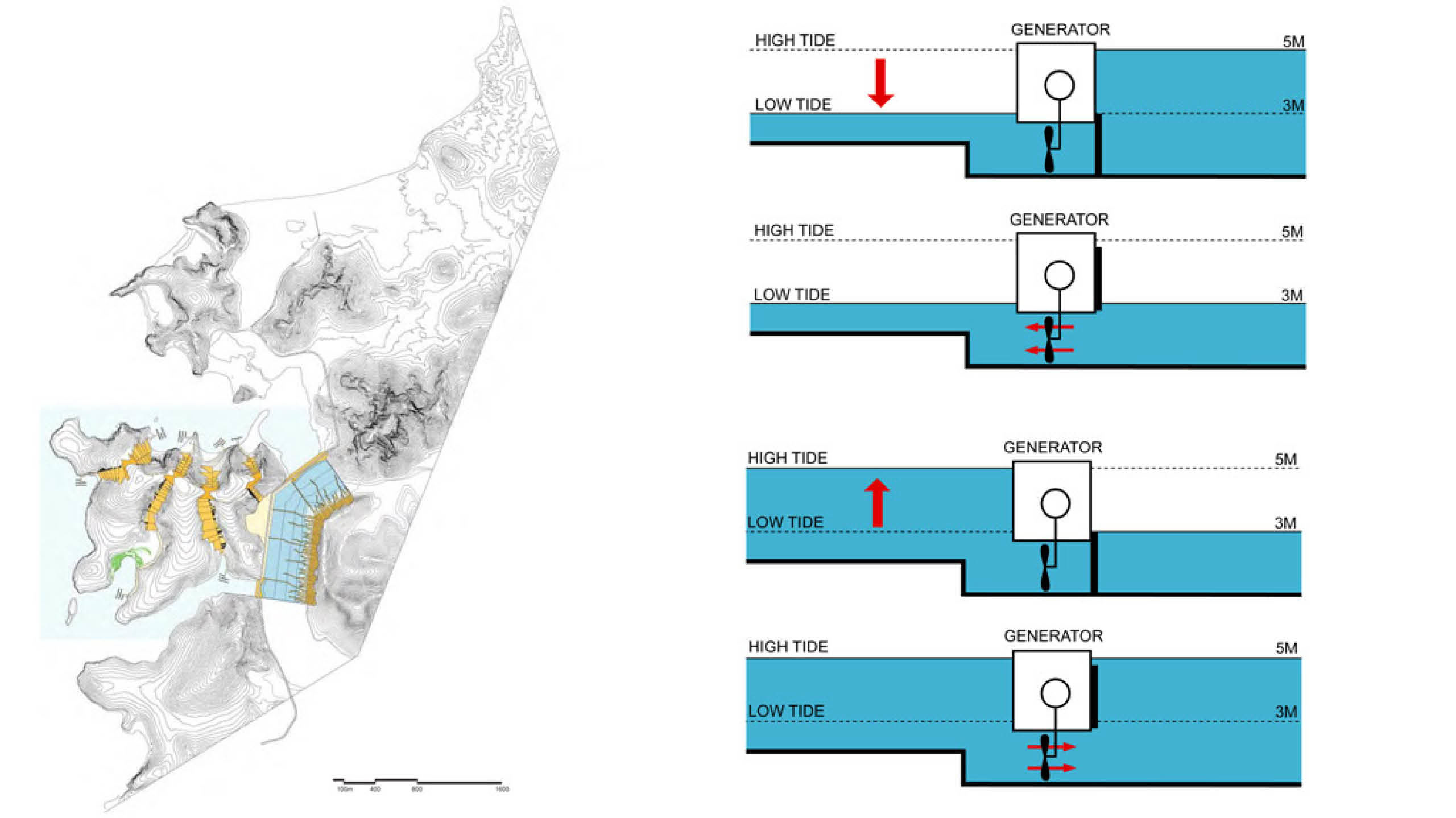
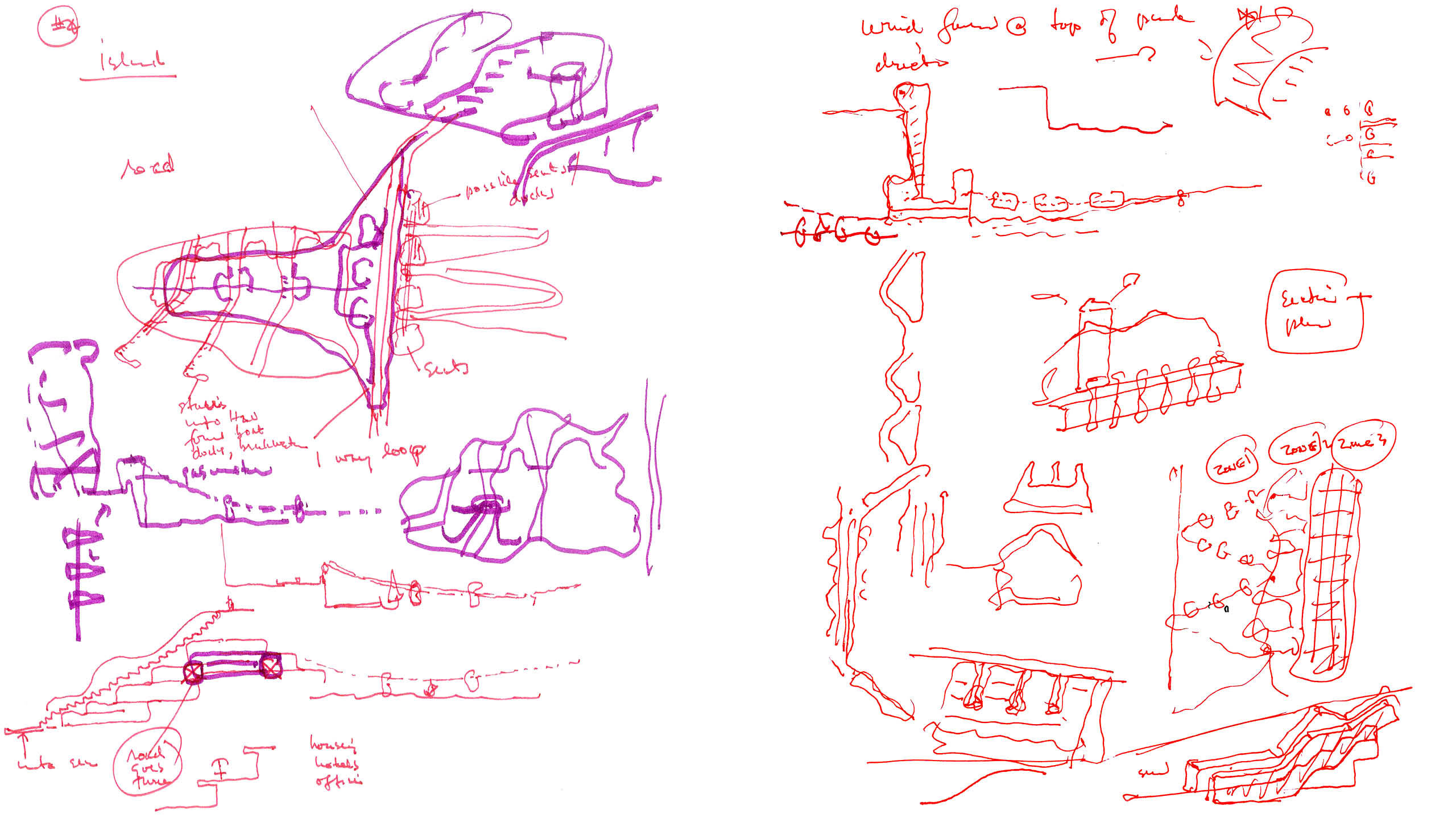
ISLAND
Concept: Produce an iconic, discrete area of development that also generates energy from natural processes.
Two dams are constructed to create an island, and the excavated material used to create a new hill. The scheme uses the tidal difference of the Sea of Cortez to create energy: as the sea level rises, water is forced through water jets, and when the sea level lowers, water is forced back in the other direction, generating power.
The movement of water to and from the Sea of Cortez creates a tidal wet zone and a tidal wet-dry zone replicating the natural tide cycles in the excavated body of water. An additional dry zone is created on the new hillside. The organization of the group of buildings to the east of this excavation responds to the different conditions: high density on the dry zone, medium density on the tidal wet-dry zone and bridging structures on the wet tidal zone.
On the island, development is limited to the natural valleys in the topography, minimizing their visual impact. Three groups of stepping buildings connect the north side of the island to the south side. A fourth group starts on the north side of the island and terminates in a plaza that faces the new body of water. Building developments in the form of stepping structures are embedded in the natural valleys of the topography. Stairs run alongside the stepping structures connecting the various levels. At the lowest levels the stairs turn into walkways that extend beyond the coast line and terminate in small boat docks.
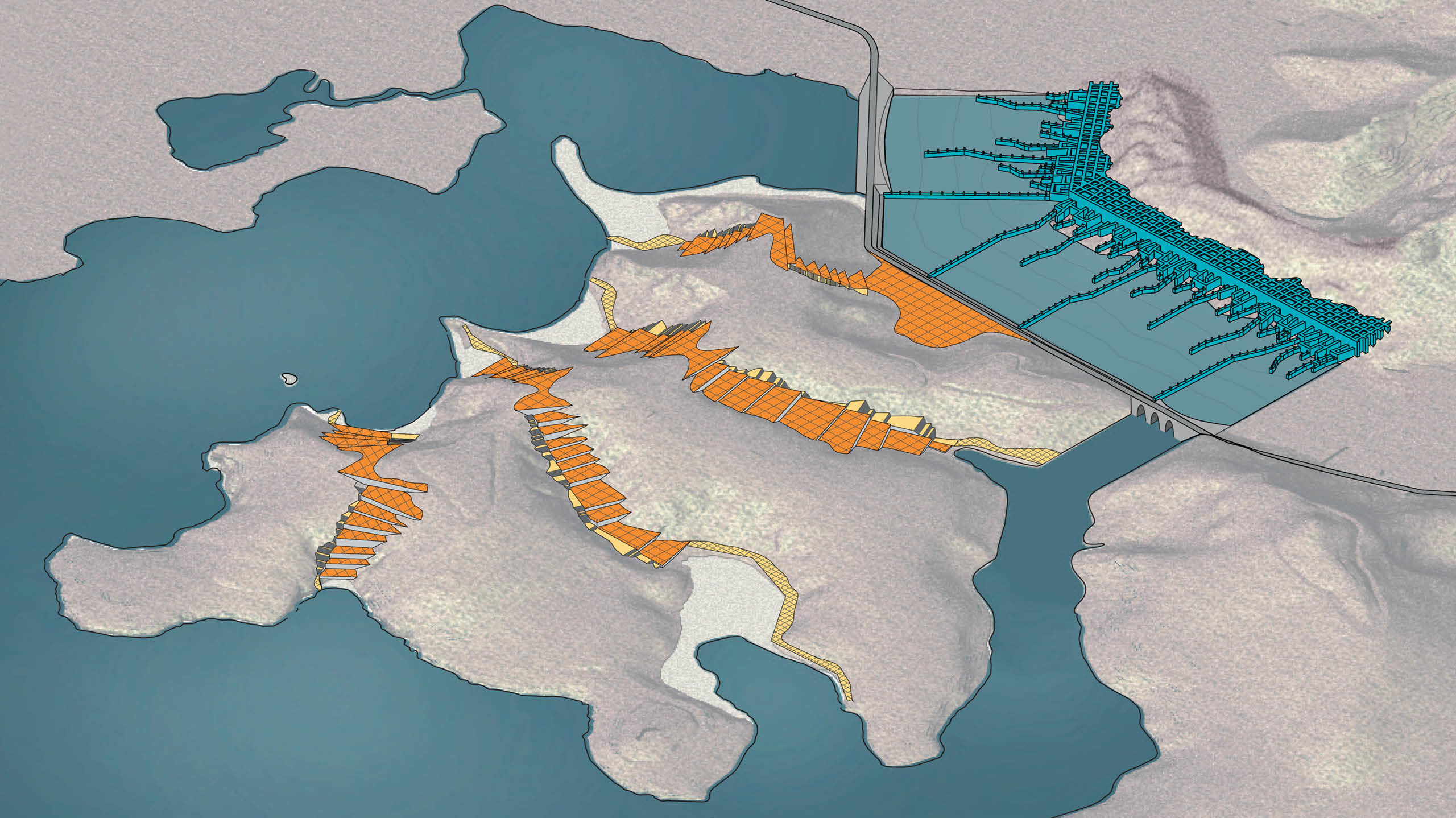
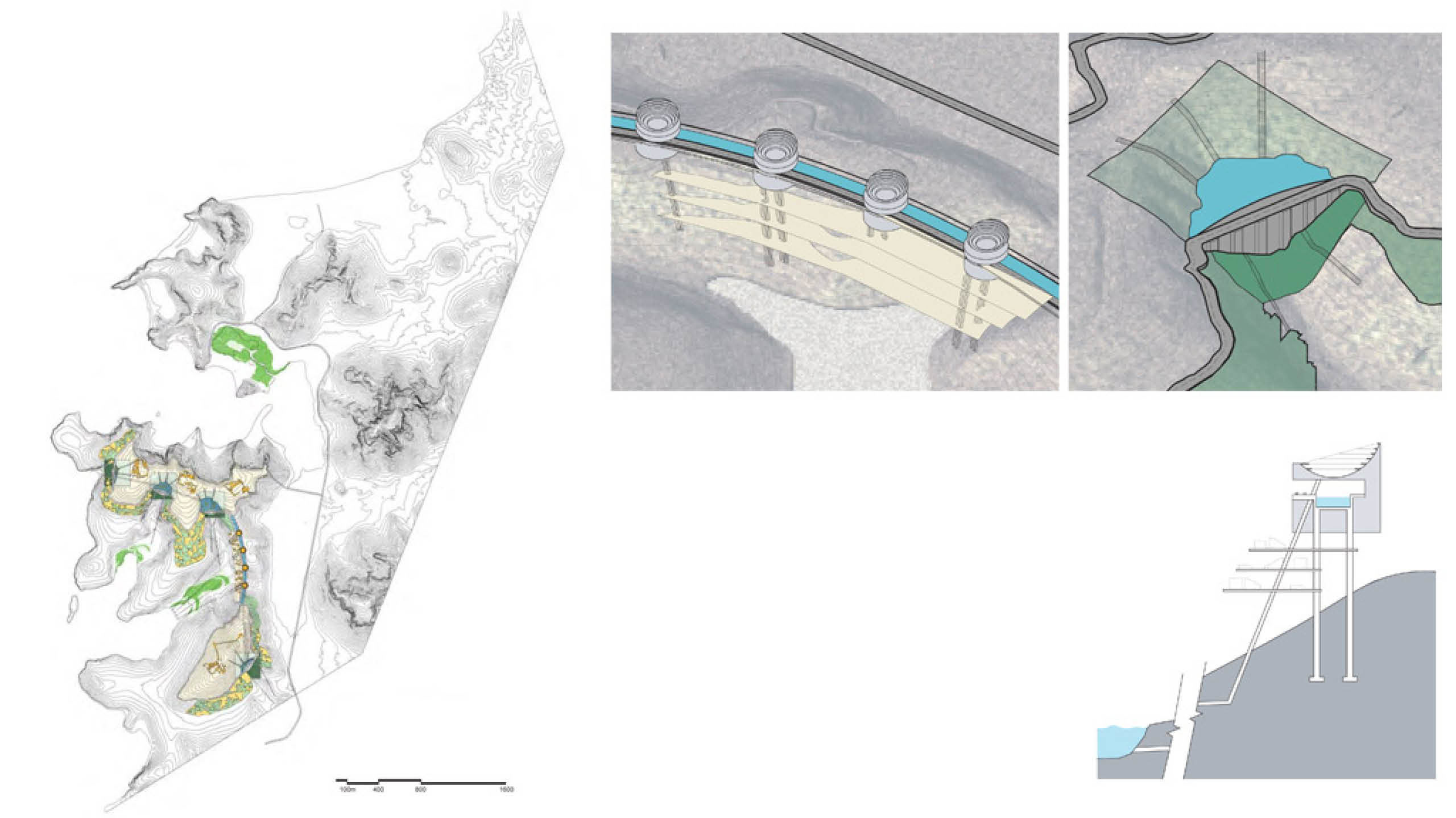
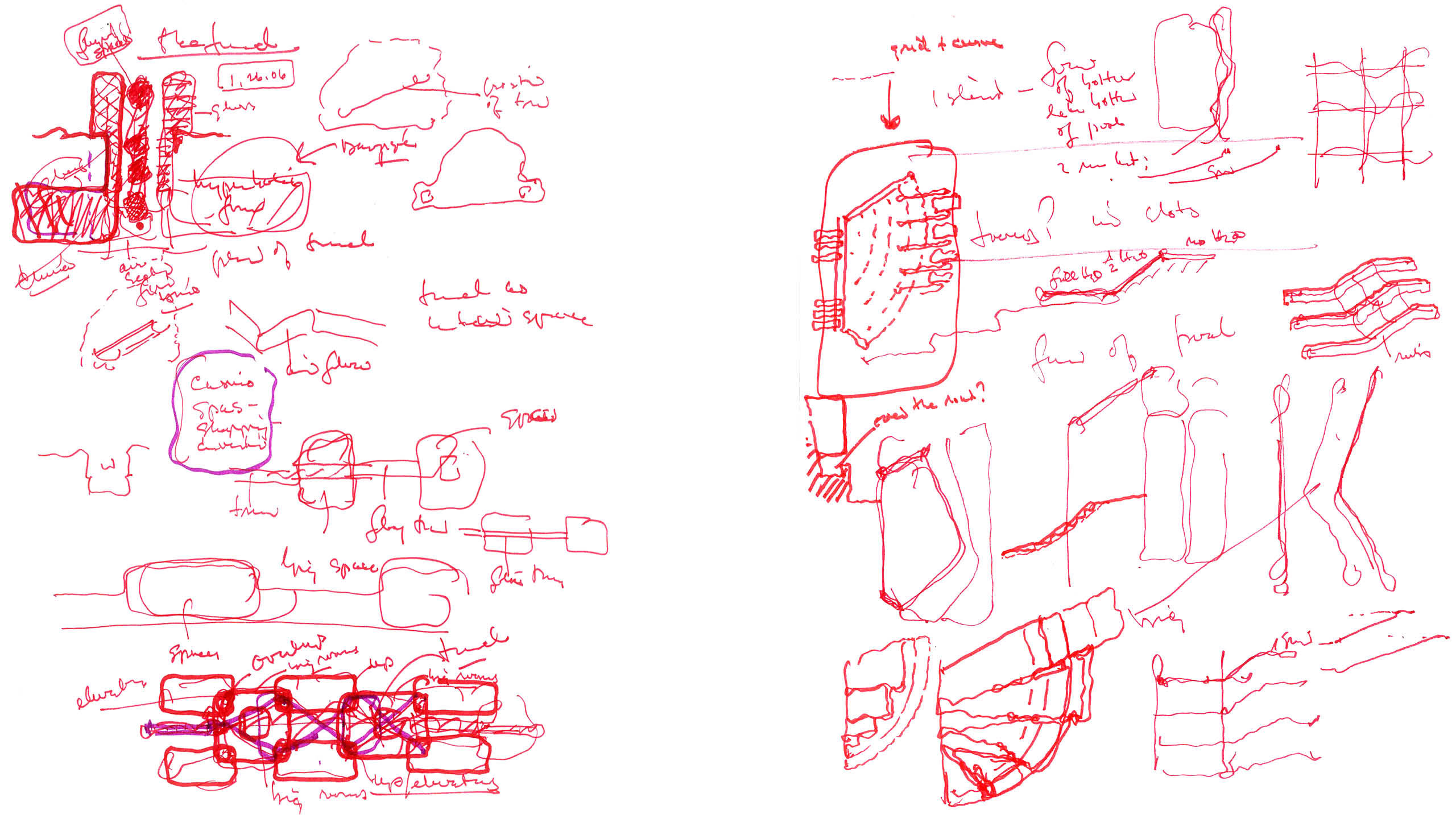
CISTERN
Concept: Exhibit ecologically sustaining processes throughout the visitor’s experience.
A road around the two peaks of the site is connected across the valley by a bridge and provides access to the development.
Solar power is collected by photovoltaic panels distributed across the site. The generated power is used to pump water from the bay up to desalinization tanks located along the bridge. The pipes that carry the water double as structural supports for terraces beneath the tanks. The desalinized water is distributed by underground tunnels to four cisterns located in the natural valleys of the topography. The road travels above the dam wall that holds the water. A portion of the stored water is used to irrigate the landscape surrounding each of the cisterns creating a series of parks that connect the bodies of water. PV panels are floated on top to provide power generation and reduce natural evaporation by shielding the water from direct sunlight.
Most of the development is located below the level of the cisterns. This allows water to be gravity-fed to the buildings. Additional power can be generated as the water is dropped from the cistern to the point-of-use. The power generated is used to pump water up to the smaller hilltop developments above the level of the cisterns.
The vertical face of each dam is used as a building type. Additional housing is placed on the terraces under the bridge.
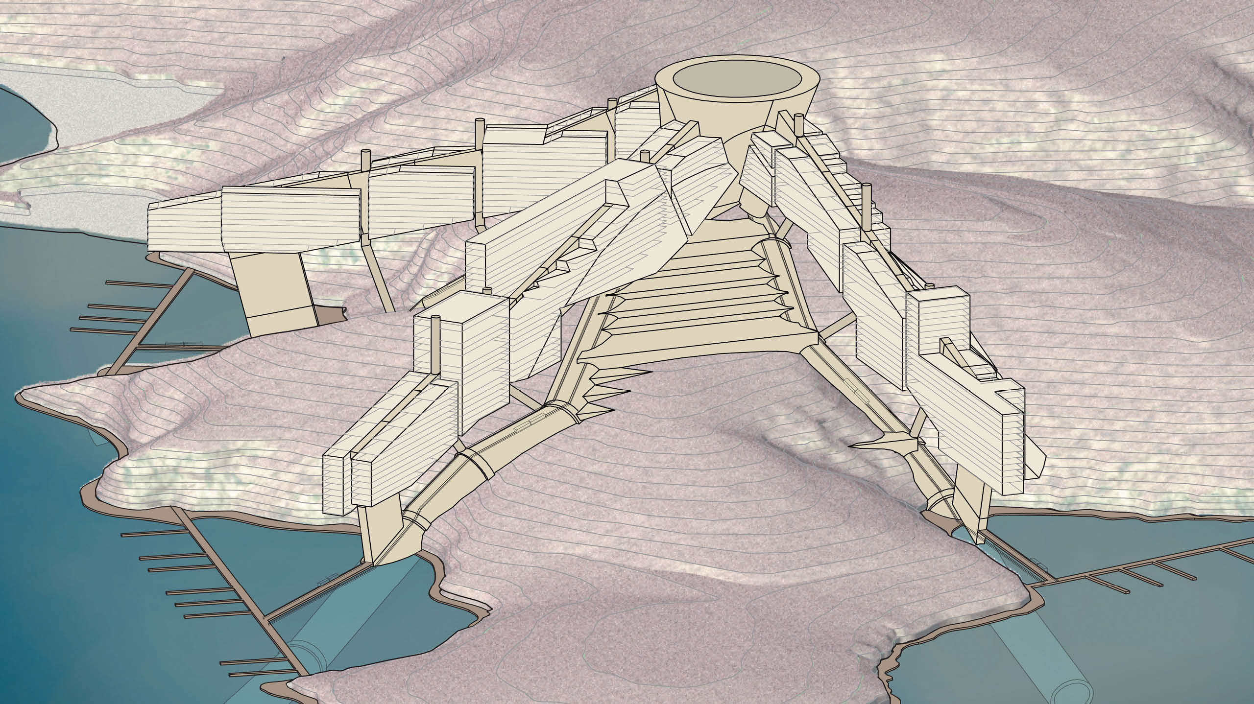
SIDESCRAPER
Concept: Create exclusivity and privacy by limiting access to the site, and reduce the overall environmental impact on the property.
Development sites are chosen based on topography. Pipes that collect and distribute sea water across the site are positioned within natural valleys and the cistern atop a promontory in order to maximize vertical water drop distance.
During the day, energy collected from photovoltaic panels power pumps that transport cool ocean water up through the pipes and into the cistern. This water is used to cool the buildings thereby
reducing air conditioning loads. At times of limited direct sunlight, collected water is released back into the ocean generating electricity by means of hydro-electric turbines located within the pipes.
The first building type is supported on a system of vierendeel trusses. Structural tubes extend from the pipe joints and support the truss. These subdivisions are organized in groups based on points of support, views and access. The second building type is terraced within the pipes. The resulting building clusters allow the project to be programmatically phased based on use requirements.
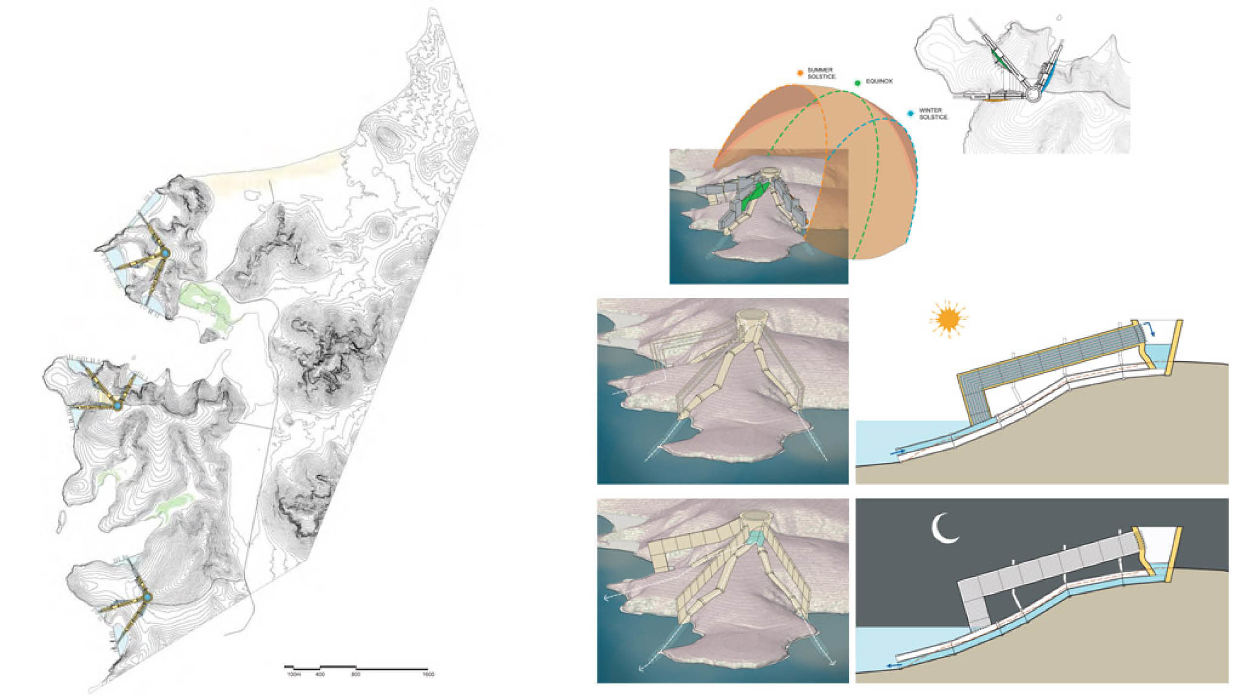
A solar envelope specific to each site is charted to identify areas of maximum solar exposure. Building elevations with southern exposure are extended and shaped by the curvature of the solar envelope.
The combined use of both horizontal roof surfaces and shaped southern elevations provide ample surface area for pv panels to generate the energy needed for the water pumping. The pv panels will also be used to help shade the areas of the building with the greatest solar exposure thereby reducing cooling loads.
Small boat harbors are created at the natural bay inlets. Pedestrian access to/from the docks and the hillside buildings is via tram lines located atop the pipe structure.