

Location
Culver City, California
Dates
1990-1994
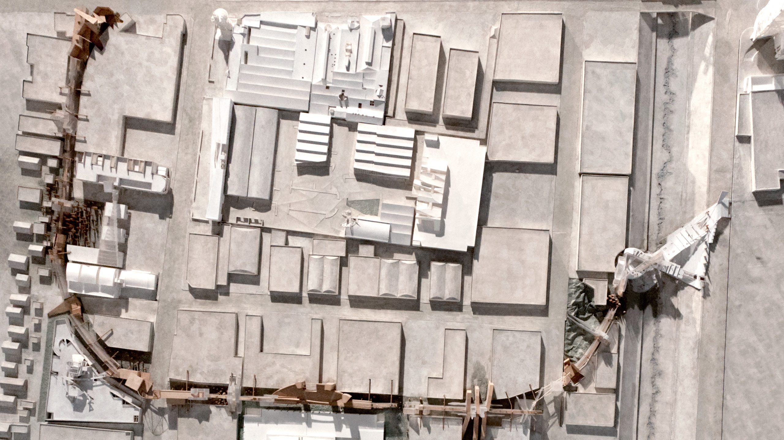
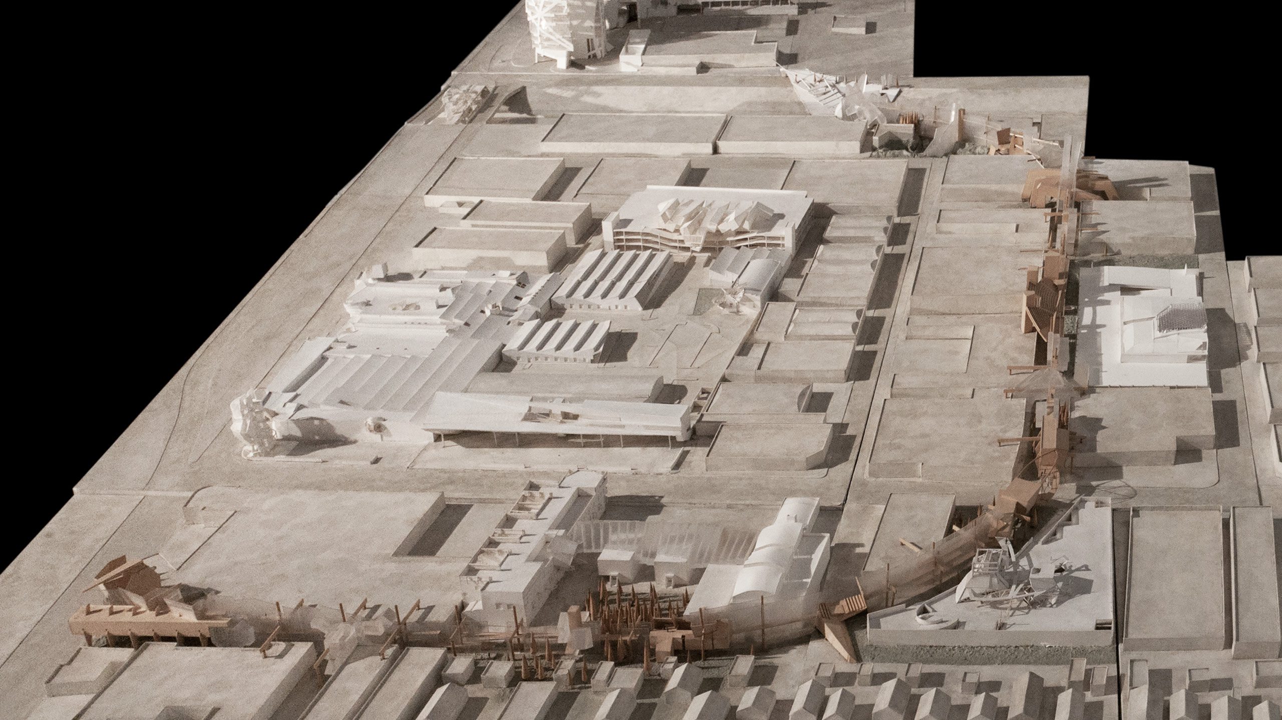
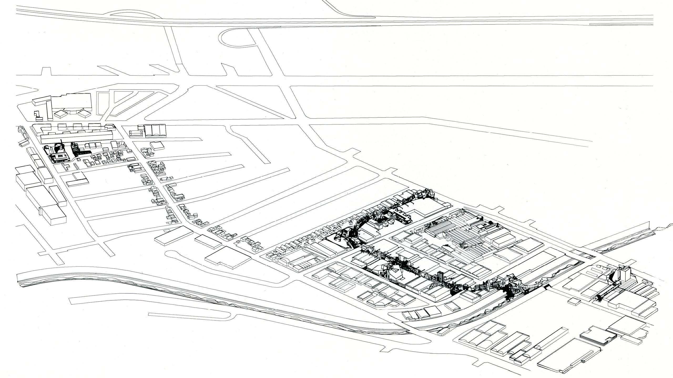
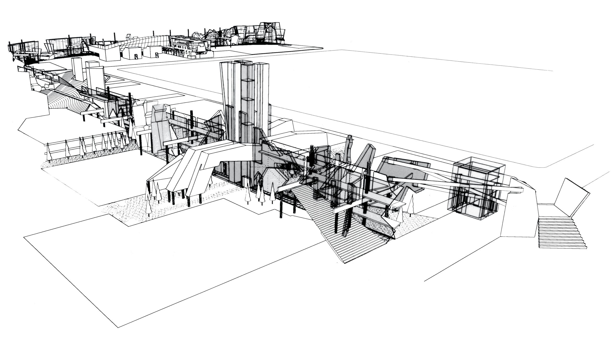
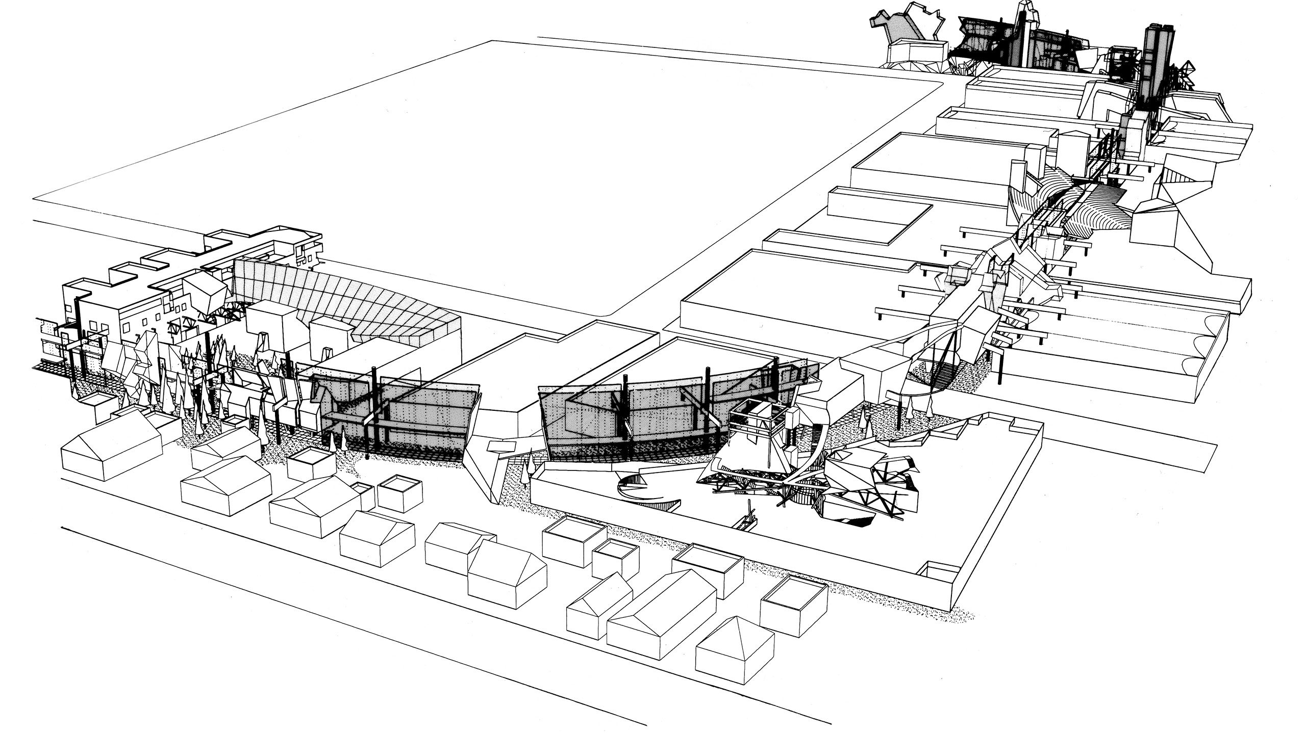
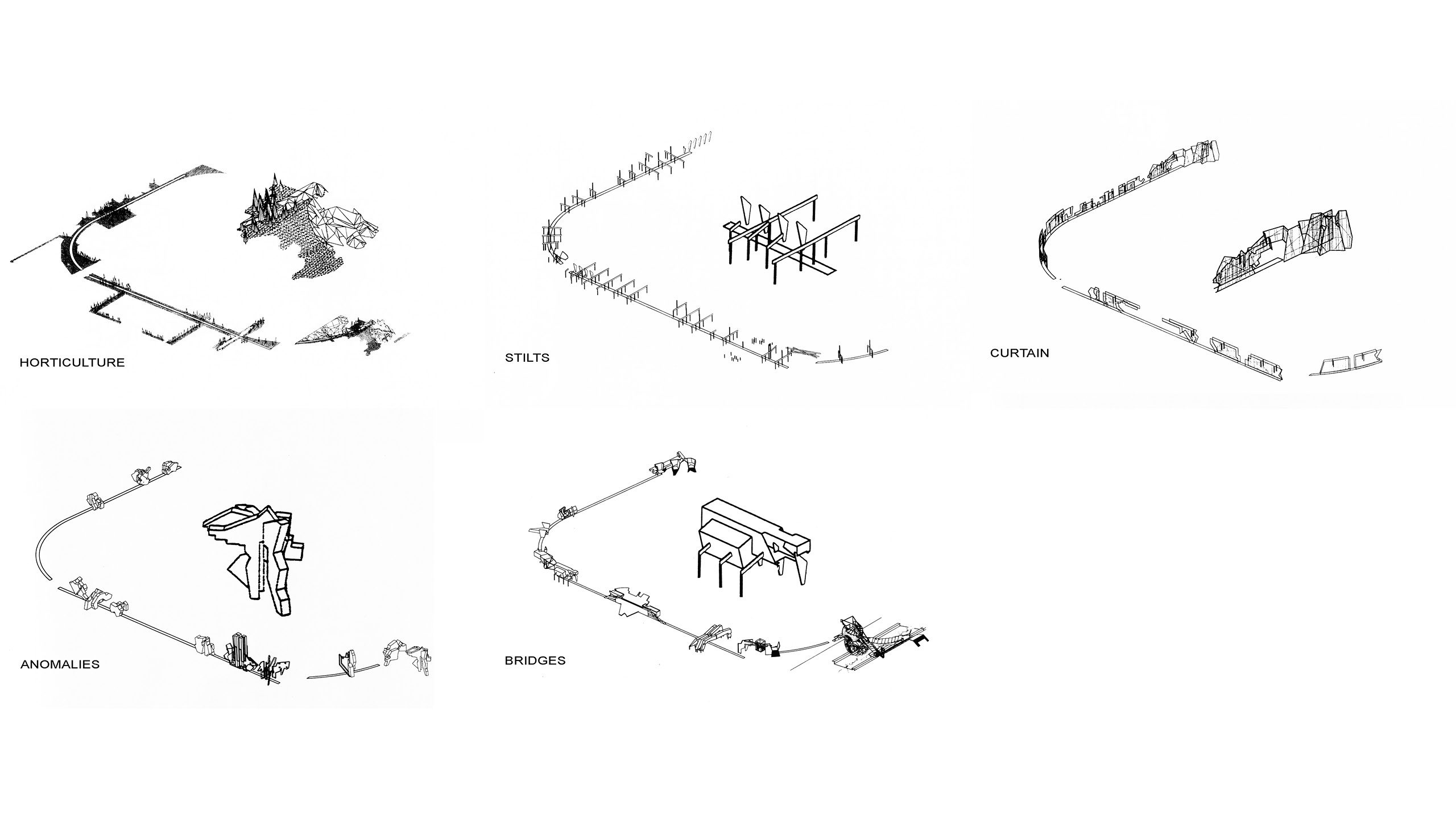
The former train right-of-way that defines the shape of the S.P.A.R.City project begins on National Boulevard and loops counter-clockwise through the development and out to Ballona Creek in the east. The distinctive shape of the spur is maintained by the industrial buildings built up around it, many of which curve to avoid the setback.
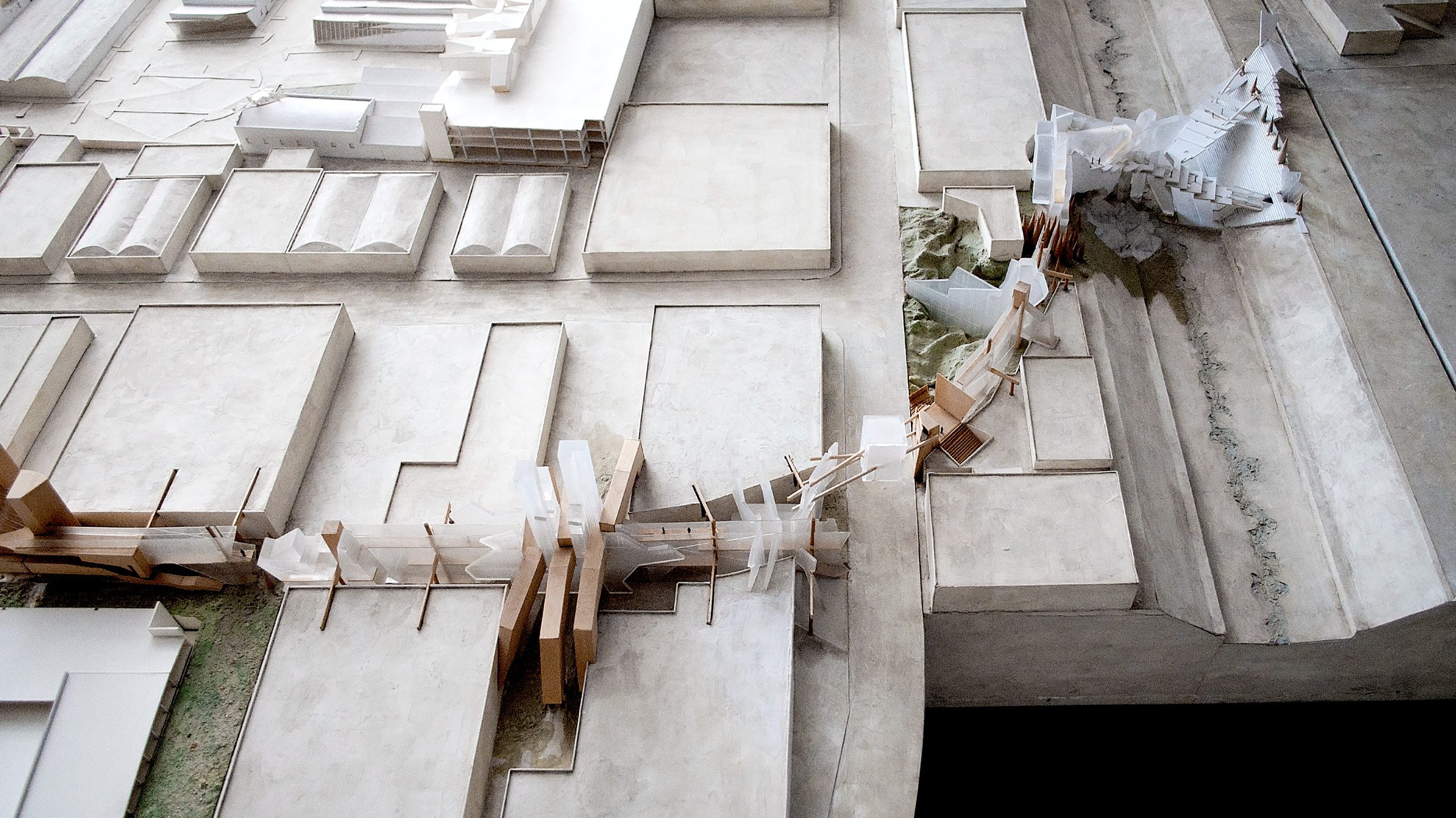
The right-of-way branches south off of National Boulevard just to the west of the intersection between National and Hayden Avenue. It begins as a large open space aside 3505 Hayden that tapers down as it continues south, parallel to Hayden Avenue, and tucked behind 3535 and 3555 Hayden. As it reaches 3585 Hayden, the site of the Waffle and Cactus Tower, it makes a wide curve east. From here it crosses Hayden Avenue and continues, parallel to Warner drive, behind the site of Warner Parking and Retail. East of this site, it momentarily spills perpendicularly into two alleys between buildings. It then begins to widely curve northward before it crosses over Eastham Drive, where it again overlaps its boundaries into a large lot along Eastham. The right-of-way terminates into the S.P.A.R.City Bridge, which crosses the Ballona Creek and The Culver City/Los Angeles border.